Sunday, February 2, 2014

Bosque del Apache National Wildlife Refuge

Sunday, Jan. 26, 2014.  Dad, Mom, brothers Ted, Rock and I head to one of my favorite bird watching places in New Mexico, Bosque del Apache National Wildlife Refuge. It's 57,331 acres of marsh and desert along the Rio Grande situated on the northern boundary of the Chihuahuan desert between two mountain ranges.

Although it is best known for the approximately 14,000 sandhill cranes and 32,000 snow geese that make it their winter home, over the years we have seen bald eagles, a golden eagle, an aplomado falcon and many more birds and wildlife.

It takes hours to drive through it because we are constantly parking the vehicle to get out with binoculars to watch the different birds and ducks. Here Dad and Mom are on one of the many observation decks that extend out over the marsh.
In past years the drought will dry up a lot of The Bosque but for now there is plenty of water.

As we stop at the first observation point we spot this Neotropic Cormorant sitting on a branch of a fallen tree buried underwater.
A few minutes later this Ruddy Duck comes swimming by.
I don't think it was very happy that I was taking it's picture because it immediately made a u-turn and left.
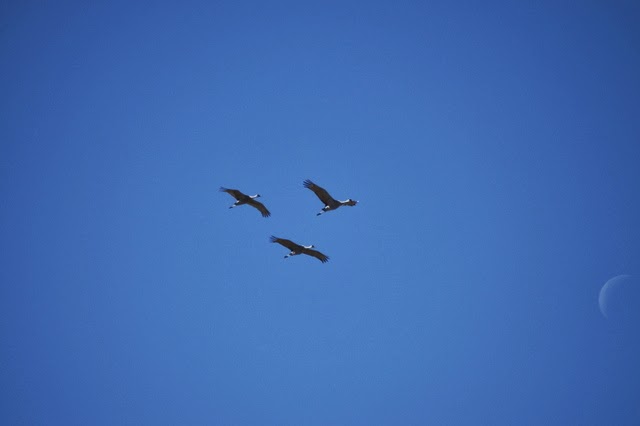
Three Sandhill Cranes fly overhead as a sliver of the moon is still visible in the midday sky.
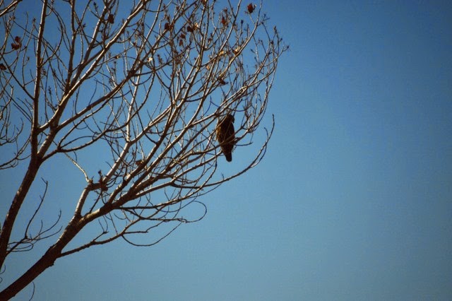
A Marsh Hawk sits in a tree scouting for lunch.
Some Snow Geese fly by making for a nice contrast between them and the blue sky.
One of the Sandhill Cranes poses for a picture.
As we prepare to leave the Bosque del Apache after a very fun day the Chupadera Mountains make a nice background for one last picture of a flock of Snow Geese.


Thursday, December 26, 2013

Grand Canyon

Sunday, Dec. 1, 2013.  Nic, Jamie and I continue our trip to the Grand Canyon.  I have been to the Grand Canyon several times and a few years ago Suzanne and I did a Rim to Rim and backpacked across it. I feel that everybody should try to see it at least once, it is that spectacular. The Grand Canyon was formed over millions of years by erosion caused by the Colorado river and by uplift of layer upon layer of rock during geologic processes.  It is 277 miles long, up to 18 miles wide and over 1 mile deep.  The first people to live in and around the Grand Canyon were the Puebloans mentioned in my previous report on Chaco Canyon.  On this particular day when we arrived a very rare event called a temperature inversion caused the canyon to fill up with fog.
In places the fog even produced some striking effects like it did with the beams of light and this tree.
Sometimes it looked like giant cliffs rising high up out of a sea.
I like all the different contrast's in this picture.
Here you can see some of the many layers of rock that make up the canyon.
It seems that the fog is starting to recede and reveal more of the vastness of the Grand Canyon.
As we continued our way on the south rim this Raven gave off a strange impression.
Finally the fog has lifted so that we could see the bottom as well as all the way across.
Nic and Jamie enjoy a moment standing near the edge.
The Grand Canyon is so immense that one picture cannot give you a true sense of it's magnitude but I tried with this panorama.
I would recommend that if you can only see one natural wonder it should be the Grand Canyon.

Sunday, December 8, 2013

Chaco Canyon

Saturday, Nov. 30, 2013.  Nic and Jamie are visiting from Maine and we decide to take a trip to see Chaco Canyon which is about 2 hours away.  We only get about 10 miles from my house when we stop to take a picture of the Chama river.

As we are driving on the road that would take us there we come upon these goats and sheep. The cute dog that was herding and guarding them made sure to stay between us and them.
Finally we arrive at our destination. Chaco Canyon is one of the great mysteries of the southwest. There is evidence that Chaco Canyon has been occupied for 10,000 years. The remains of the buildings that we would see today were inhabited from 850 CE to 1150 CE. by the Chacoans, who are the ancient ancestors (Anasazi) of today's Pueblo nations. I work for the Ohkay Owingeh Pueblo located at the confluence of the Chama and Rio Grande rivers. Not much is known about the Chaco culture except that much of their architecture and ceremonies were related to astronomy. It was also the center of a large trade network that extended all the way to southern Mexico and the Pacific ocean. In fact cacao, conch shells and the remains of Macaws were found among the ruins. The first place we stop at in Chaco Canyon is a great house, or settlement, called Chetro Ketl.
One of the most striking features in all of the different Chaco Canyon settlements are the Great Kivas or ceremonial chambers. This one at Chetro Ketl is very large and you can see the sitting bench at the inside bottom of the circular wall.
Some of the smaller Kivas have very different shapes.
A look inside one corner of the outer wall shows some of the architecture used at Chetro Ketl.
This picture of Jamie at the back wall shows just how long and straight it was. It's amazing how perfect the construction was since they had no modern tools to work with.
As we leave Chetro Ketl to walk the trail to Pueblo Bonito we pass some petroglyphs etched into the cliff walls that both of these settlements were built up against. This one is a weird looking person, maybe an alien.
Pueblo Bonito, Spanish for "Beautiful Town", is the largest of the great houses in Chaco Canyon. In places it was four stories high. This picture only shows a small part of it.
This picture shows some of the many rooms on the interior.
The Great Kiva at Pueblo Bonito.
There were many smaller Kivas which might have been for a particular clan or family.
Nic and Jamie inspect the inside of a room. The logs and sticks that you can see in the tops of the window and door were for support and the ones protruding from the walls were the ceiling of one story and the floor of a higher one.  They are approximately 1,000 years old. The Chacoans cut about 225,000 trees to use in building the Great Houses in Chaco Canyon and had to haul them 40 - 60 miles from the closest forests.
This window built into a corner is actually an astronomical marker. When the sun rises on the morning of the winter solstice, the shortest day of the year, it's rays enter through the window and strike the wall behind.
Finally, on the back side of Pueblo Bonito, looking up at the outside wall you can see a straight groove cut into the stone with large logs beneath. This was where there was a balcony, maybe for sitting on to watch the sunset or to enjoy some fresh air.
The Great Houses of Chaco Canyon show that the Chacoans were capable of difficult engineering accomplishments and had an extensive knowledge of astronomical events. They were a mysterious but highly advanced people.


Sunday, September 29, 2013

Kamas Lake

Monday, Sep. 23, 2013.  On my way to pick up Suzanne for our backpacking trip I was driving through Colorado and as it started to rain this rainbow formed right before my eyes. You can even see the end going into the ground.

As we neared the trailhead we passed Provo Falls and I had to stop and take a picture.
It was Suzanne's first backpacking trip in 8 years since her car accident. You can see she didn't take it easy by the size of her pack.

Shortly after we began we came to this bridge.  It didn't look to be very sturdy so we decided it was easier to just step across on the rocks.
The trail was hard to see at times and mostly was big rocks that could trip you if you weren't careful.
Along the way the view of the surrounding mountains was spectacular.

After some very tough hiking we finally arrive at our destination, Kamas Lake.  It is at 10,400 ft. elevation in the high Uinta mountains on the border of Utah and Wyoming.
This picture shows just how blue and pure the water is at this elevation.

After setting up camp I make a pot of green chile stew for dinner.

After dinner as we were sitting by the lake the sun was setting and made the mountains glow like gold.  The reflection in the lake was an almost perfect mirror image.
A group picture to commemorate a very successful and fun backpacking trip.
Grandpa Tom, Hazel, Suzanne and Dooley.


Sunday, September 8, 2013

Nambe Lake

Saturday, Sep. 7, 2013.  My love of high mountain lakes led me to research which ones in my area I had not visited.  I found that Nambe Lake is high up in the Pecos Wilderness of the Sangre de Cristo Mountains which are the southern range of the Rocky Mountains.  After driving to the trailhead I crossed this little bridge to begin my hike.
You can see from this picture that the trail is full of rocks so I had to be careful not to twist an ankle, or worse, which was difficult because I was always looking up at the Aspens.
I followed a mountain stream most of the way and sometimes there were little waterfalls like this one.
Sometimes the view was of the bare rocky part of the mountains where very little grows.
And sometimes the view was of the green meadows and trees growing on the mountains.
Finally, after a tough 4.35 miles I reach 11,400 ft. elevation and there before me is Nambe Lake.  I think it is the most beautiful lake I have ever seen.
Nambe Lake is classified as a High Mountain Alpine Lake and it was very clear and pure.  I spent a long time just meditating in the solitude and peaceful feeling it inspired.
I would love to take my grandkids on the hike to Nambe Lake someday.