Sunday, November 9, 2014

Pony Express Trail

Friday, October 24, 2014.  Suzanne and I want to spend the next three days exploring the portion of the Pony Express Trail that extends from Salt Lake City west to the Utah/Nevada border. After California became a state in 1850 faster communication with Washington D.C. and the east coast became critical.  The fastest way to deliver mail was by stagecoach which took 8-12 weeks. In 1860 a group of 3 men came up with the idea for the Pony Express.  The trail covered the 1,966 miles from St. Joseph, Mo to Sacramento, Ca.  There were 120 riders that were paid $100.00 per month to ride 75-100 miles per day and they could not weigh more than 125 lbs.  There were 400 horses used and they had to be small and fast which is why they were called ponies.  They had stations set up approximately 10 miles apart which is about how far a horse can gallop before it gets tired.  It was a very dangerous ride that could include outlaws or Native American attacks but it reduced communication from the east to California to 10 days. After driving west from Salt Lake City we get on a small dirt road that parallels the Pony Express Trail. Sometimes the road is the trail. It can be difficult to see and follow so you are constantly looking for the markers.
After driving up to the top of Little Mountain we come to Lookout Pass where one of the rest stations was. From here we would descend down to the desert floor for the remainder of our adventure.
As we continue on we come to Simpson Springs which was an important Pony Express station due to the water source. Here is one of the stone markers erected at each of the stations.
Our next goal for Friday is to find a place to set up camp. It won't be easy because we have entered the Great Basin and it is desolate and we need a spot with a few trees for shade for the doggies and us.  Most of the terrain looks like this.
Finally, right as we are approaching the point where we will need to turn around to insure we can get back to a gas station Suzanne thinks she sees some trees in the distance. We find a place where we can get off the road and set up camp.
After dinner we relax and enjoy the sunset.
It may be desolate but it sure is beautiful.
Saturday morning Suzanne decides to improvise a skillet breakfast. Fried potatoes, dehydrated pizza soup and scrambled eggs all mixed together. Wow, was it good.
After breakfast we decide to go exploring. We spend the next few hours hiking around the area adjacent to our camp.
Hundreds of square miles of nothing and suddenly we spot this solitary Globe Mallow.
Back at camp Suzanne and Dooley take a break.
Sunday morning we hike up on top of a small nearby mountain to discover an amazing view on the other side.
After packing up we start to leave this area when we encounter a herd of wild mustangs which seemed like a fitting conclusion to our Pony Express Trail adventure.

Sunday, October 19, 2014

Great Western Trail

Friday, August 8, 2014.  Suzanne, the doggies and I head up to the area of Northeast Utah to find a spot where we can set up camp and then spend a couple of days hiking part of the GWT. The Great Western Trail extends from Canada to Mexico passing through Montana, Wyoming, Idaho, Utah and Arizona.  Our intent is to hike all of the over 500 miles of the GWT through Utah. Since we don't have the time to thru-hike it we will do it one section at a time until we have hiked the entire Utah corridor. We find a place to set up camp off a tiny dirt road near the Idaho - Utah border. Our view from camp, actually in Utah, is of the beautiful Idaho countryside.
Rather than leave our footprint by setting up a new camp we use one that was left by others. We would never build such a large fire ring but this one was already here. After unpacking and getting every thing situated, Suzanne and Dooley take a break.
While exploring the area around our camp I spot this before and after scene and thought it made a nice picture.
This pair of Three Toed Woodpeckers were sharing the same tree.
The next morning we begin our quest of hiking the Great Western Trail through Utah.
It's actually a very nice trail with a lot of green trees providing shade.

As we continue hiking we see this tree where a bear had recently sharpened it's claws.
The views were really spectacular and we took our time so we could enjoy them.
As we near the end I can't resist a picture showing just how blue the sky was.
All in all we hiked the first 8 miles of the Great Western Trail in Utah and I am really looking forward to our next section.

Sunday, June 22, 2014

Red Lake, Colorado

Thursday, June 12, 2014.  Hazel and I drive up to the South San Juan Wilderness in Southern Colorado to meet up with my brother Ted for 3 days of camping and hiking. When we discovered this camping spot last year we named it wildflower meadow because in July it is carpeted with every color of wildflower you can imagine. This skyrocket is just waking up for the day.
The next morning started out with a good sign. It was Friday the 13th and the full moon was setting behind our camp making for a good picture.
As we were having our morning coffee and looking out over the lower meadow two bull elk walked to within 50 yards of us. They kept trying to figure out what we were but we remained still. Eventually they began to frolick and play and chase each other around.
The hike we had planned to do was to Red Lake. We had seen the trail head last year while exploring and a hiker we met on the Continental Divide Trail had told us it was a very nice hike. After getting our hiking gear ready we started up the trail.  We hiked about 3 miles up to 11,750 ft. elevation and all of a sudden there was Red Lake before us.
Red Lake is one of the most picturesque settings I've ever seen. Here is a closeup showing Conejos Peak at 13,179 ft. in the background.
 Back near camp I can't resist a picture of the Cumbres Pass that is just a little west of us.
The view from our camp is spectacular.
The time of day can change the effect dramatically.
Sometimes each mountain ridge has a different degree of shadow.

As we prepare to leave one of my favorite birds, the Western Tanager, stops by to say goodbye.
It was a very fun and relaxing three days and I will come back here often.

Sunday, February 2, 2014

Bosque del Apache National Wildlife Refuge

Sunday, Jan. 26, 2014.  Dad, Mom, brothers Ted, Rock and I head to one of my favorite bird watching places in New Mexico, Bosque del Apache National Wildlife Refuge. It's 57,331 acres of marsh and desert along the Rio Grande situated on the northern boundary of the Chihuahuan desert between two mountain ranges.

Although it is best known for the approximately 14,000 sandhill cranes and 32,000 snow geese that make it their winter home, over the years we have seen bald eagles, a golden eagle, an aplomado falcon and many more birds and wildlife.

It takes hours to drive through it because we are constantly parking the vehicle to get out with binoculars to watch the different birds and ducks. Here Dad and Mom are on one of the many observation decks that extend out over the marsh.
In past years the drought will dry up a lot of The Bosque but for now there is plenty of water.

As we stop at the first observation point we spot this Neotropic Cormorant sitting on a branch of a fallen tree buried underwater.
A few minutes later this Ruddy Duck comes swimming by.
I don't think it was very happy that I was taking it's picture because it immediately made a u-turn and left.
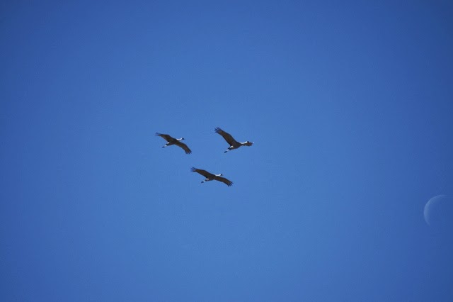
Three Sandhill Cranes fly overhead as a sliver of the moon is still visible in the midday sky.
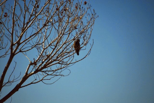
A Marsh Hawk sits in a tree scouting for lunch.
Some Snow Geese fly by making for a nice contrast between them and the blue sky.
One of the Sandhill Cranes poses for a picture.
As we prepare to leave the Bosque del Apache after a very fun day the Chupadera Mountains make a nice background for one last picture of a flock of Snow Geese.